Book Tickets Online
About
Position: Lat 54° 13’.6N Lon 04° 41’.7W
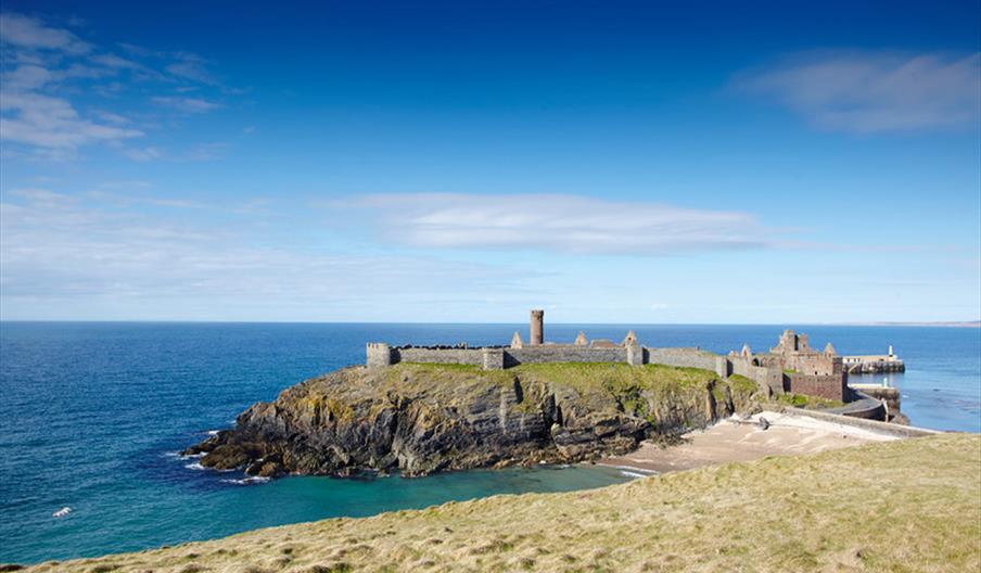
The port of Peel is located on the West coast of the Isle of Man.
VHF: Channel 12
Harbour Hours: Daily, or when vessels are expected
Admiralty Chart: No. 2696 (plans in the Isle of Man)
Admiralty Sailing Directions: No. 37 - West Coasts of England and Wales, including the Isle of Man
Port Agents:
Neptumar (IOM) Limited - Tel: +44 (01624) 649617
Anchorages: Good holding ground can be found ½ to 1 mile Northwards of the breakwater in depths of 10 to 15m. An alternative anchorage for Cruise liners is Port Erin bay, where passengers may be landed on the jetty to the west of Raglan Pier – as instructed by the Outports Manager.
Restrictions: Enter harbour only on instructions from Harbour staff.
At Anchorage: No restrictions.
Alongside: Cruise Vessels: 90m length x 5.0m draught at seaward end of Breakwater.
NB 1: These maximum criteria may be increased, depending on tidal levels prevailing, following consultation with the Harbour staff, but at their absolute discretion.
Entry: Subject to notice and only on instruction from Harbour Office via VHF Channel 12.
Port Limits: Shore side of a line running NW’ly from Thistle Head to a point ¾ mile from the head then in a straight line to Gob-y-Deigan.
Directions:
Entry is gained on the leading marks (F1. R 5 secs on the end of the Groyne and on the cupola of the Pumping Station on the promenade) heading 204°. In daylight use the light structure on the end of the Groyne and Power Station Chimney leading 205°. Both lines lead clear of the obstruction (4.9mdepth) just off the end of the breakwater.
Harbour is untenable in strong winds from NE through N to NW.
Delays may be experienced in periods of fresh to strongwinds. Alternative port may be offered.
Max. Tidal Range: From 0.2 to 5.4 above C.D. (5.2metres) on high spring tides.
Pilotage: Is not compulsory but is available with prior notice to Agents or through the Harbour Pilot, Mr S Carter. Telephone: +44 (0) 1624 861724.
Tugs: No tugs available.
Radar: No radar coverage.
ID Cards: Required for ISPS Code purposes.
Facilities: Cruise liners, anchored, may land their passengers at the steps on the breakwater at all states of the tide. Alternatively, over the high water periods, passengers may be landed on the steps at the East Quay Tongue in the Inner Harbour. Where vessels’ tenders are used for such landings, such tenders must have valid certification and carry all necessary safety equipment.
Gangway: Not available.
Water: Fresh water is available at all commercial berths by arrangement.
Fuel: Fuel is available by road tanker through Agent or directly through:
Manx Petroleums: +44 (0) 1624 691691
CPL Petroleums: +44 (0) 1624 673551
Ellan Vannin Fuels: +44 (0) 1624 844000
Waste Disposal: Garbage skips or wheelie bins available on all piers. Limited waste oil disposal - contact Harbour Office.
Cranes: Assorted mobiles up 50t SWL by arrangement through Agent.
Stevedores: By arrangement through Agent.
Security Watchmen: By arrangement through Agent.
Linesman: By arrangement through Agent.
Port Manager: Mark Kenyon, Harbours Division, Department of Infrastructure, Sea Terminal Building, Douglas, Isle of Man. IM1 2RF
Telephone: +44 (0) 1624 686628 Fax: +44 (0) 1624 686403 Email: MarineOperationsCentre.DOI@gov.im
Peel Harbour Office: +44(0)1624 842338 (During office hours, 7 days per week)
Customs & Excise: +44 (0)1624 648100
Port Agents: +44 (0)1624 833955, +44 (0)7624 324234


